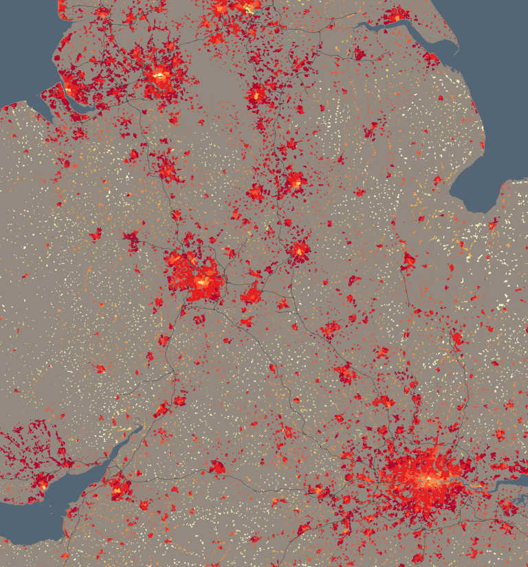
One of the more spatially interesting datasets on DataShine: Census is about central heating – do houses have it, and what is the fuel source? The table is QS415EW and here’s what one of the categories – proportion of houses with gas central heating – looks like on DataShine (and above). You’ll notice a distinctive pattern, with city centres and the countryside having low proportions of houses with gas central heating (yellow), while city suburbs and towns have much higher proportions (red). City centres may have these low values because they contain either very old houses (which never had it) – and/or very new houses that use more modern forms of central heating, are much more highly insulated, or are blocks of flats where gas central heating systems are perhaps considered dangerous now. In rural areas, some of these places maybe never had a connection to the gas main anyway. It’s the city suburbs, the big expansion of the 60s/70s, where gas central heating was always put in by default.
Oil central heating, being more expensive, is rare in urban areas but a practical necessity in the countryside, such as in rural Wales. Solid fuel is popular in Northumberland.
Barrow Island in the Lake District and Aberdaron in Wales are the two wards that have the highest proportion of households with no central heating at all. Many of the houses in the area at least are holiday houses, which are presumably mostly populated in the summer. It could be a bit chilly there in the winter!
See the live map on DataShine now. Change the fuel type at the No. 3 drop-down on the top right.